Posts

Showing posts with the label cartography

"Places & Spaces: Mapping Science" exhibit @ NRC-CISTI
Image
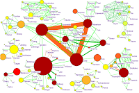
It is very exciting that the Places and Spaces: Mapping Science exhibit from Indiana University will be on display at NRC-CISTI from April 3 - June 27 2008. This is the first time this collection of amazing maps of science is on display outside the U.S. The diverse and creative collection includes traditional cartographic maps, concept maps and domain maps. These are all physical paper (+other media) maps, and also includes some hands-on maps made specifically for children to interact with. Congrats to all involved at NRC-CISTI and in particular my CISTI Research colleague Jeff Demaine who was the originator and champion of this initiative. References: Boyack, K.W., Klavans, R., Börner, K. (2005). Mapping the Backbone of Science . Scientometrics, 64 (3), 351-374. Update: 2008 April 15: Indiana University SLIS Events News: Mapping Science Exhibit at the National Research Council - Ottawa, Canada

Ranting about maps

Both as a Canadian who has enjoyed the rants of Rick Mercer and as someone who spent a lot of time working with geographers at the Atlas of Canada (and even enjoying some of it!), I am appreciating the convergence of these two things as embodied in the self-described rant by Martin Dodge and Chris Perkins ( Reclaiming the map: British Geography and ambivalent cartographic practice ) In their rant, the Royal Geographical Society (" the heart of geography ") is roasted for using a (" Mc-Map ") Google Maps location map on the back of the RGS-IBG 2007 Annual International Conference programme. While concerned with this and the apparent decline of mapping in geography ( Geographers Don’t Map Anymore Do They? ) and the sub-discipline of cartography ( Cartographers: Who Needs Them Anymore? ) I think their conclusion that mapping is actually easier and possibly better and making a popular and significant resurgence ( Mapping Reinvigorated? ) through mashups (including ...